

Land Ecosystem Atmosphere Program (LEAP) - Gingin Flux Tower Site
Investigators and Partners
This site is currently operated by:
- Dr Caitlin Moore (Micrometeorology & Ecophysiology)(UWA)
- Prof. Jason Beringer (Micrometeorology)(UWA)
- Dr. Richard Silberstein (Hydrology)(Adjunct UWA & ECU)
Project Overview
The site provides nationally consistent observations micrometeorology (climate, radiation, fluxes of carbon and water). The tower provides long-term measurements as part of Australia and New Zealand’s Ozflux network, the global FLUXNET network, and TERN-NCRIS. The infrastructure is funded through the TERN-NCRIS Ecosystem Research Infrastructure facility.
The Site Location
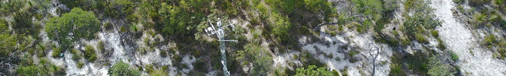
The Gingin flux station is located approximately 80km north of Perth, Western Australia. It was established by CSIRO in June 2011 and the flux instrumentation is now managed by Richard Silberstein of Edith Cowan University. The Gingin OzFlux Site is located at: 31.376331 S,115.713730 E and 47m elevation. It is sited on land traditionally owned and managed by the Yued group of the Noongar people
Site Characteristics
The flux tower site is located within an area of banksia woodland. Elevation of the site is 47 m. Climate information comes from the nearby Gingin AEro BoM AWS station 009178 (1968 to present) and shows mean annual precipitation is approximately 632 mm with highest rainfall in July of ~126 mm each month. Maximum temperatures range from 33.2?C (in Jan) to 18.3?C (in July), while minimum temperatures range from 6.2?C (in July) to 17.3 ?C (in Feb).
Data
Data from this site is available through the OzFlux data portal international FLUXNET database or via the investigators email [email protected] or [email protected].
Further Information
- Dr. Caitlin Moore
- Prof. Jason Beringer
- Dr. Richard Silberstein
- School of Agriculture and Environment
- Terrestrial Ecosystem Research Network (TERN)
- Terrestrial Ecosystem Research Network (TERN) Ecosystem Processes
- The Australian Flux Network (OzFlux)
- Critical Zone Exploration Network
- The National Collaborative Research Infrastructure Strategy (NCRIS)
- The International FLUXNET
Acknowledgements
This site is produced by Prof. Jason Beringer, UWA, School of Agriculture and Environment and proudly part of the Australian Flux Network(OzFlux) and supported by the Australian NCRIS Terrestrial Ecosystem Research Network (TERN).

|
Instrument |
Make |
Model |
Description |
|
Atmospheric Pressure |
Vaisala |
CS106 |
2.5m |
|
Net Radiation |
Campbell Scientific |
CNR4 |
4m |
|
Data logger |
Campbell Scientific |
CR3000 |
Ground |
|
Open Path CO2 H2O |
LI-COR |
Li-7500 |
2.5m |
|
Rain gauge |
Campbell Scientific |
CS702 |
Ground |
|
Soil heat flux (two replicates) |
Hukseflux |
HFP01 |
0.1m |
|
Soil temperature |
Campbell Scientific |
TCAV-L |
0.08m |
|
Sonic anemometer |
Campbell Scientific |
CSAT3 |
2.5m |
|
Temperature and Relative Humidity (two replicates) |
Vaisala |
HMP45AC |
2.5m |
|
Soil Moisture (6 replicates) |
Campbell Scientific |
CS616 |
0.1, 0.2, 0.4, 0.8, 1.2, 2.0m |
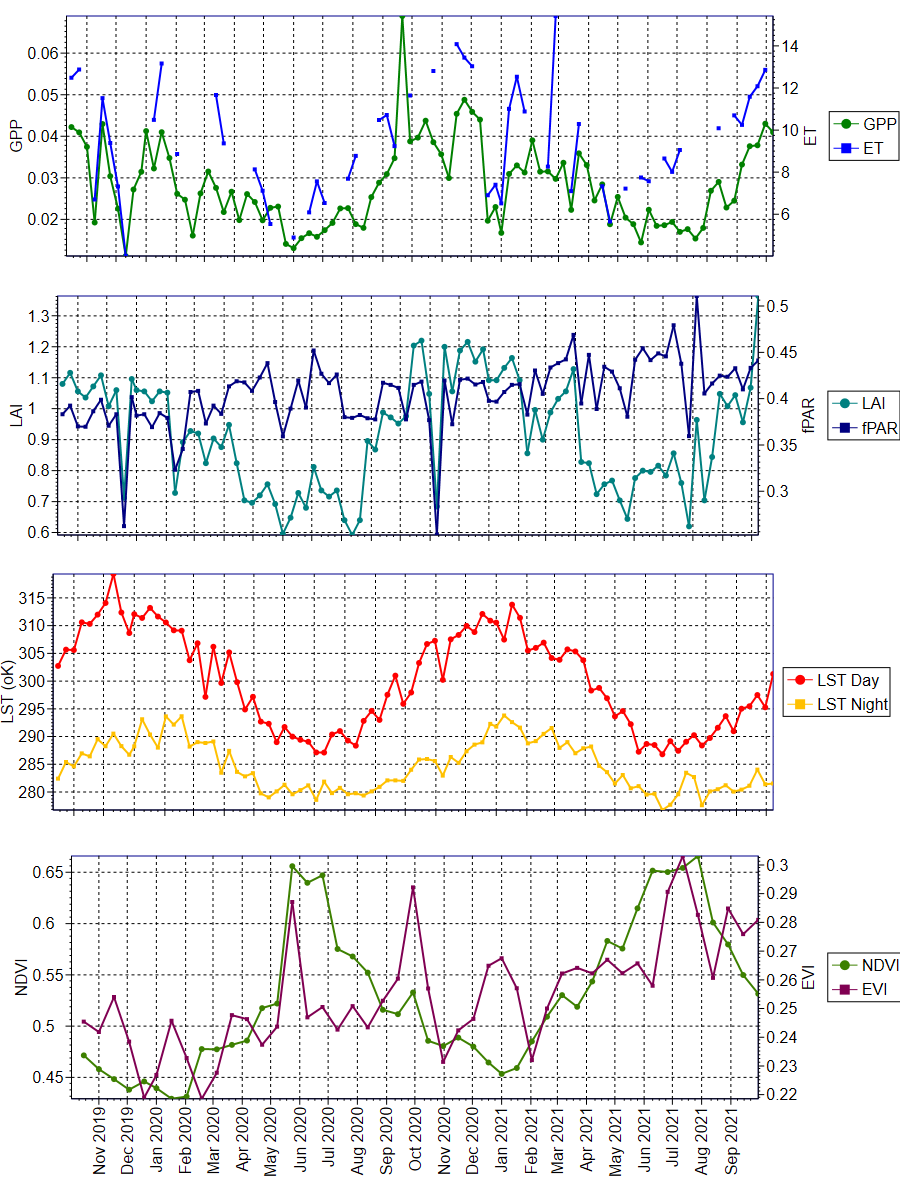
The data was obtained from the Oak Ridge National Laboratory Distributed Active Archive Center for Biogeochemical Dynamics (ORNL DAAC) (https://daac.ornl.gov/MODIS/). The ORNL DAAC provides MODIS Land Product Subsets for model validation, site characterisation and remote-sensing purposes.
Daily updated data was obtained from this provider, with an area of 3x3km extracted using Python script. The plots were produced using QC Filter Conditions 000 and 001. Condition 000 represents the highest QC Filter possible and 001 represents a reliable and usable QC Filter, though not to the standard of 000.
University information
CRICOS Code: 00126G